|
 |
 |
 |
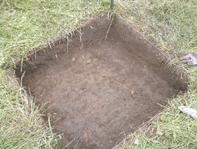 |
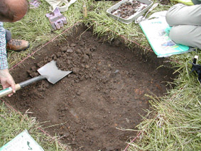
Once the baseline was established, Roy and the team could start removing the sods. All sods were checked for broken pottery or lost coins and other artefacts. The image shows the trench in the initial stage of 20cms. |
Trench at 30 cms [half way down]. Note the soil changes colour at this depth. From the rich plough soil to a sandy clay colour. |
 |
 |
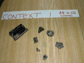
Context One
Showing medium to large coal deposits. The nearest coal boring was situated within the areas of Breightmet Hill West and Bailey Lane. |
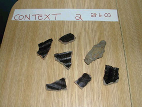
Context Two
Showing several broken sherds of brown glazed earthenware, probably 18th century in date. |
 |
 |
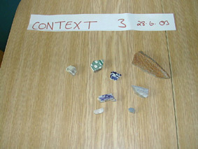
Context Three
Small sherds of Victorian / Edwardian Tableware. |
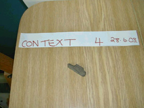
Context Four
One fragmented piece of wood was unearthed. The species of tree is unknown. |
 |
 |
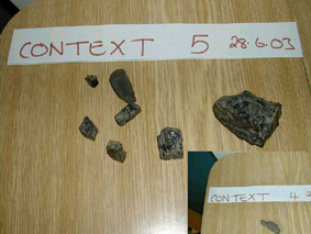
Context Five
More coal deposits were found in this layer. Coal was found in the brook [Blackshaw better known as Middlebrook]. This brook is only 20 yards from the site and separates the three former townships of Breightmet, Harwood and Ainsworth. |
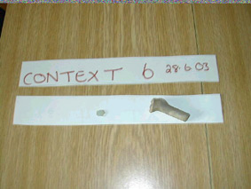
Context Six
Was the richest of all contexts'. The image shows one small piece of glass [date unknown] but probably late medieval. The clay pipe was dated from 1660 - 1730. Clay pipes are a good dating material. This context was the last and dates this small 1m x 1m test pit to the late 17th century, if not to dark days of medieval life. |
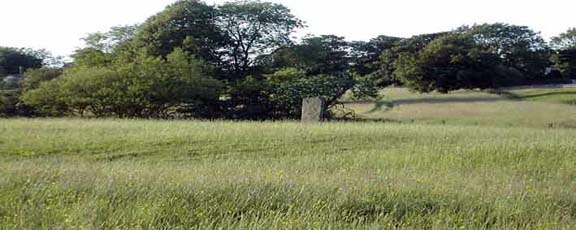
The Dry Hillock Project
Time Team Big Dig
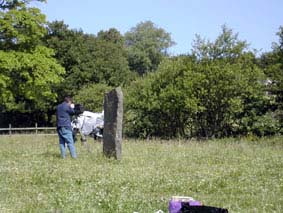
This standing stone stands alone, against the backdrop of enclosed fields and scattered farmsteads. This stone can be reached by walking via the footpath, which starts on Stitch-mi-Lane (facing the Lychgate at Harwood Parish Church). Walk down, and keeping Deepdale Road on your right-hand-side and Harwood Lodge on your left-hand-side, after 1-2 minutes you will come across a stile. Climb over the stile into the field [beware of the brown horse it can be cantankerous at times] still walking down [heading towards Breightmet Golf Club], and keeping Deepdale Road on your right-hand-side. You will eventually cross a small and narrow foot bridge, once you have crossed the foot bridge, look sharply right, you can now see the standing in the adjacent field [Dry Hillock].
Once you have arrived at the stone, you may note by looking at the Ordnance Survey Map that there is no archaeology inscription, attaching this site to any ancient burial ground or to any Roman activity which could be associated with the stone. Yet,this stone is clearly marked on the 1845 Map of Breightmet. The current occupier of Dry Hillock, Mrs. Holt, clearly states, that the standing was erected [date unknown] to depict the Roman Road to Affetside. Mrs. Holt refutes the claim that I put to her, that the standing stone was probably erected by the previous occupier/s of Dry Hillock, during the height of the Victorian / Edwardian [romantic] period.
The stone is crudely carved if not chiselled from a slab of sandstone. It resembles a rather large medieval gate post, than an archaeological feature, depicting Breightmet's Heritage. Sadly, neither English Heritage or Manchester Archaeological Unit, has any documents relating to this extraordinary landscape feature. In fact, both institutions claim that they never heard of the standing stone. Yet, remarkably, this stone is almost a carbon copy of the many standing stones, which can be found scattered in and around our ancient country. Many standing stones were erected to depict or to describe ancient boundaries or track ways. There are no ancient scripts or marks upon this stone. Could this un-recorded standing stone marked the intended route to Affetside or did the Romans reject the chosen route and change their minds at the last minute and left the standing stone in situ, just to confuse the 21st century archaeologist and historian. Or could this standing stone just be a folly in the landscape?
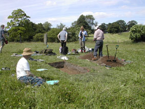
Before any digging took place a full Pre-Excavation Research was carried out. This consisted of a full resistivity metre survey [two weeks prior to the dig taking place], to establish, any hidden underground features. The second pre-excavation task was to do a intensive field [grid] walking within the fields of Dry Hillock [5 metres square grids]no broken sherds of pottery were found, within 30 square metres of the standing stone. I also contacted English Heritage and the National Trust, to establish if the site was classified and if any previous excavation/s had taken place at Dry Hillock the answers came back Negative. Also contacted Bolton Metropolitan Borough Council regarding if any underground water/ gas or electric pipes where in the vicinity. The answer was also Negative. Visited Lancashire Record Centre and Bolton Archives to obtain the relevant maps regarding Dry Hillock and this infamous standing stone.
With the dig in full swing. I invited Look Northwest BBC-1 Regional News Programme, to come to Dry Hillock and film a live dig. They jump at the chance including the producer of the programme, the broadcaster, Abbey Jones and Cameraman Kevin can be seen filming via the now famous standing stone. Mr. Roy Pennington, was the star of the show with making a cameo appearance on the show, were he gave a brief outline of the dig. He has never been the same since.
|